Distance: 46.4 miles. Elevation: 6716 ft.
The Great Saint Bernard Pass
or Col du Grand Saint-Bernard (Fr), or Colle del Gran San Bernardo (It)
Is this the longest pass (end-to-end) in the Alps? It certainly felt like it when I drove across it in my van a few days ago, stuck in 3rd gear for ages on the long ascent and almost cooking my brakes on the descent. From the Rhône valley at Martigny, Switzerland to the Dora Baltea river in Aosta, Italy, it’s 50 miles (80km) ! That’s if you go over the pass like I did, and not through the tunnel. It’s the 3rd highest pass in Switzerland, and the 7th in Italy.

I’m staying at Gignod, which is about a quarter of the way up the climb from Aosta. I had planned a bike route from here to Col du Grand Saint-Bernard a couple of years ago, but had no real intention of doing it on this trip because I expected it to be heaving with traffic, with the Mont Blanc tunnel currently being closed. But when I drove over the pass a couple of days ago from Switzerland, traffic was not excessive at all, and that encouraged me to take it on, while I’m in the area.
The weather forecast suggested Sunday would be the sunniest day. I was sure that, being a sunny Sunday, it would be teeming with motorbikes and fast cars, with the col sign obscured by selfie-hunting bikers, which I’ve seen before.
I decided it would be cheating to do the climb from Gignod, so before the ride I redesigned the course to descend five miles to Aosta first and do the full climb from there, using the quieter, longer and lumpier road on the eastern side of the Butier valley out of Aosta (some of which I had done on my Giro di Aosta ride three days ago), rejoining the main road at Étroubles, thirteen miles later.
After a porridge and honey breakfast, I left at 10:13. Weather was sunny, breezy and around 14°C. I wore shorts and short-sleeved jersey but put my rain jacket on for the short descent to Aosta.
The first 15 to 20 minutes were down the main road – easy peasy – just free-wheeling. Groups of noisy cars disturbed the otherwise peaceful Sunday morning, but no bikers, yet…
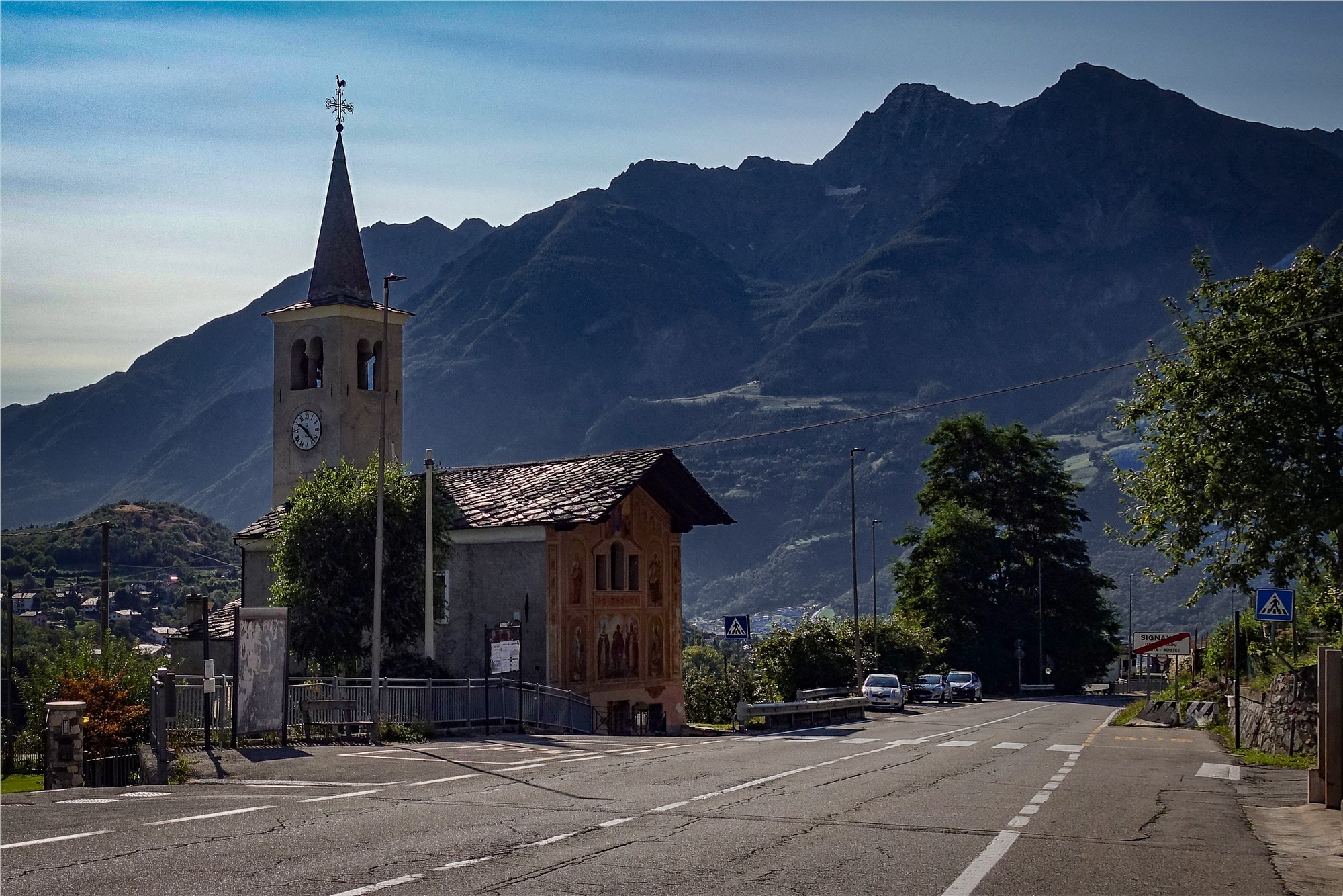
Down into Aosta I turned left across the river Buthier and then straight into the climb that I did a couple of days ago. I took my rain jacket off. The road passes through a series of small villages.

That back-road route from Aosta to Étroubles climbs 2,800 ft in thirteen miles, which sounds okay with an average of 5%, but it is very rolling with some steep climbs, flat bits and descents.
I could hear noisy cars over the other side of the valley. Even on the back roads were some groups of cars racing each other. But that was only in parts. Overall the road was extremely quiet and I’m glad I took that route.
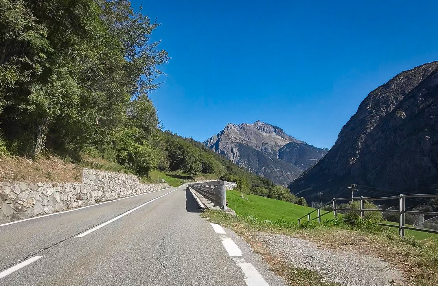
Eventually I saw the main road on the other side of the valley, and was surprised to see that I was actually much higher than it, which meant I wouldn’t have any more climbing to do before reaching it. In fact the road levelled out and then descended to join the main road at the foot of the long, straight 10% climb to Saint-Oyen.
I was already level with Saint-Oyen, so it was frustrating that I had to lose hard-won altitude by descending to the foot of that 10% climb. On the main road it was busy; cars going by all the time, although not completely nightmarish. Thankfully there were no lorries, being a Sunday.
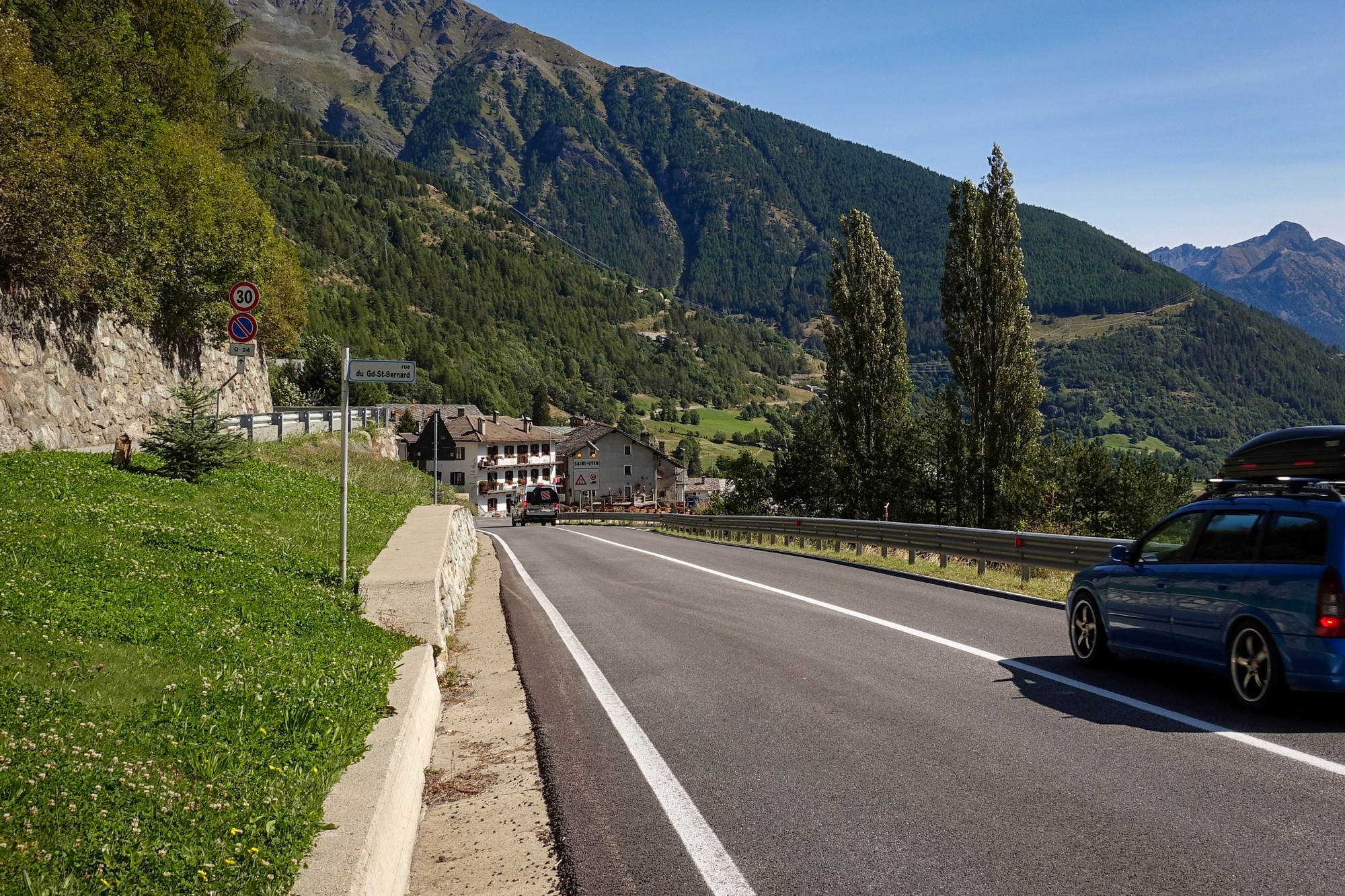
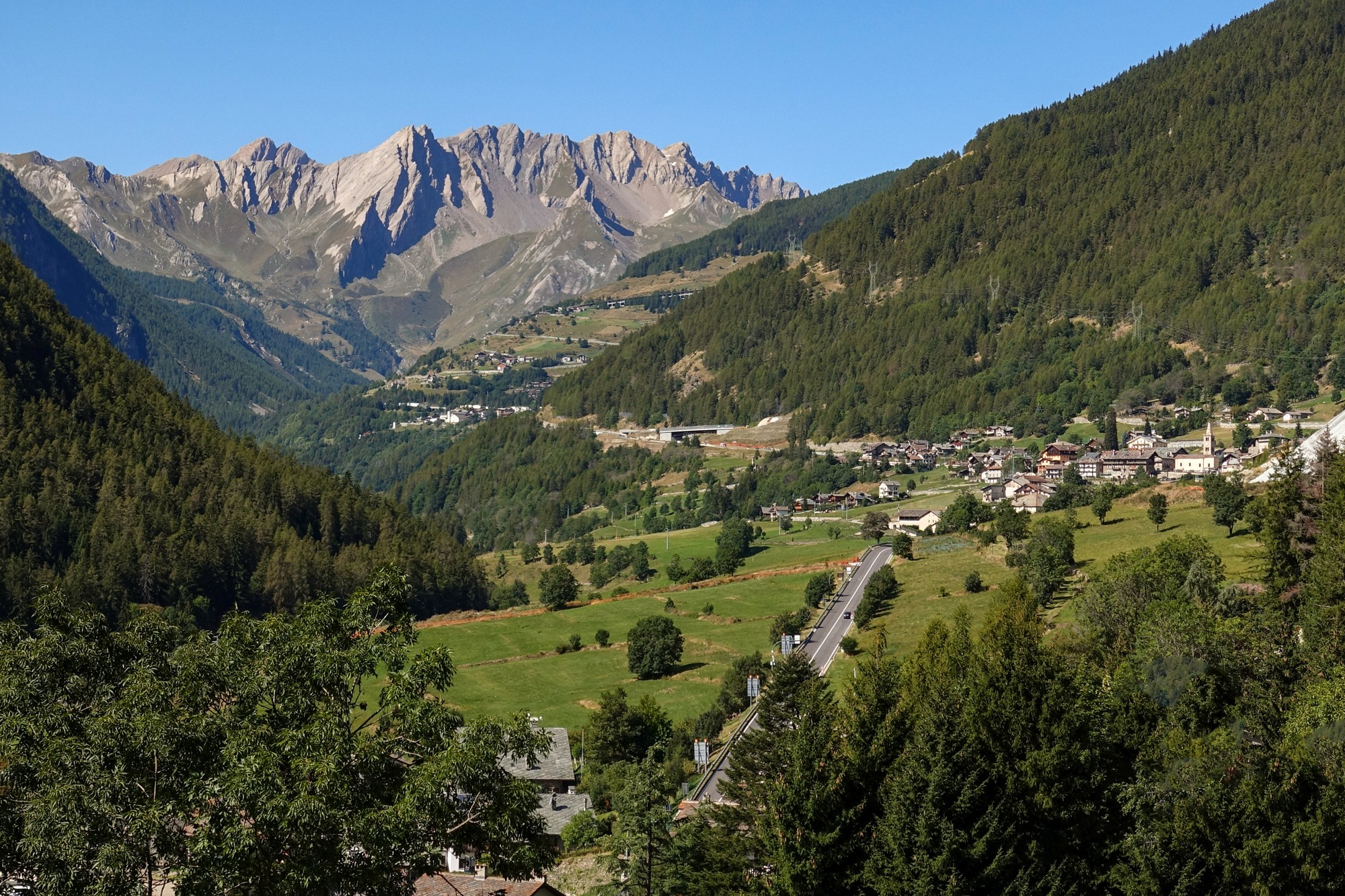
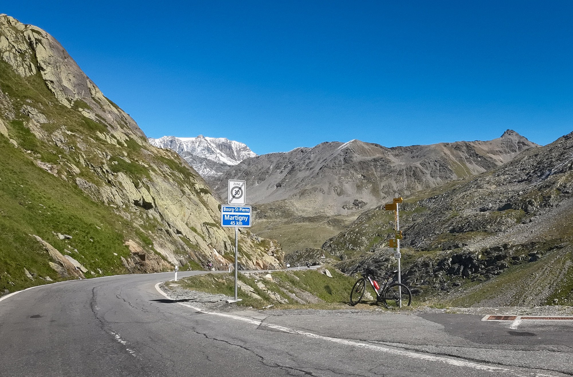
A mile past Saint-Oyen comes the point at which most of the traffic carries straight on towards the tunnel, whereas I turned right, onto the road up to the pass. There was less traffic and hardly any loud cars or motorbikes, so that was good.
At first there are views over the valley to the left.
A couple of miles later the road crosses the valley and climbs through forest. Here I found it difficult to keep over to the right because of twigs and branches over the road on that side. The wind was blowing the treetops wildly about, although I was somewhat sheltered from it under their cover.
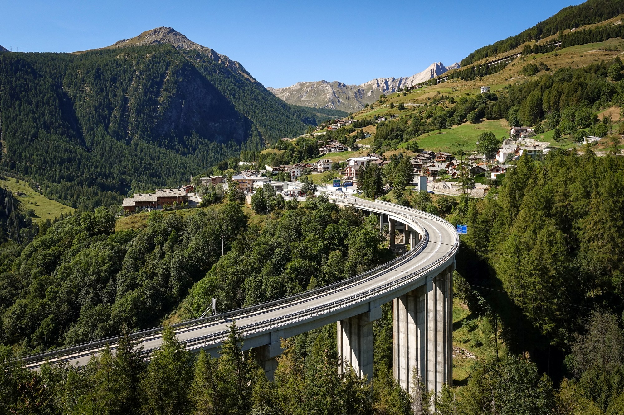
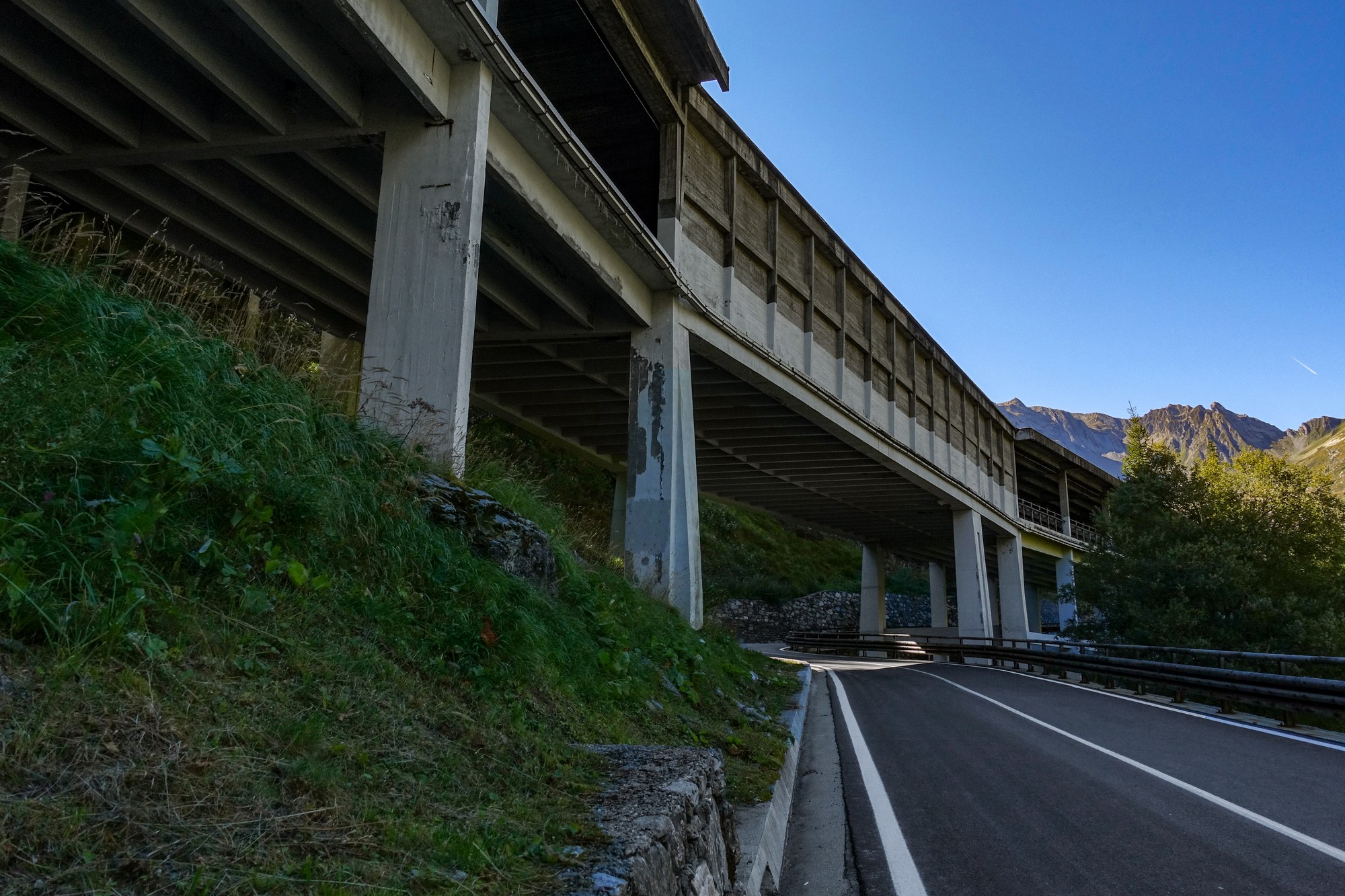
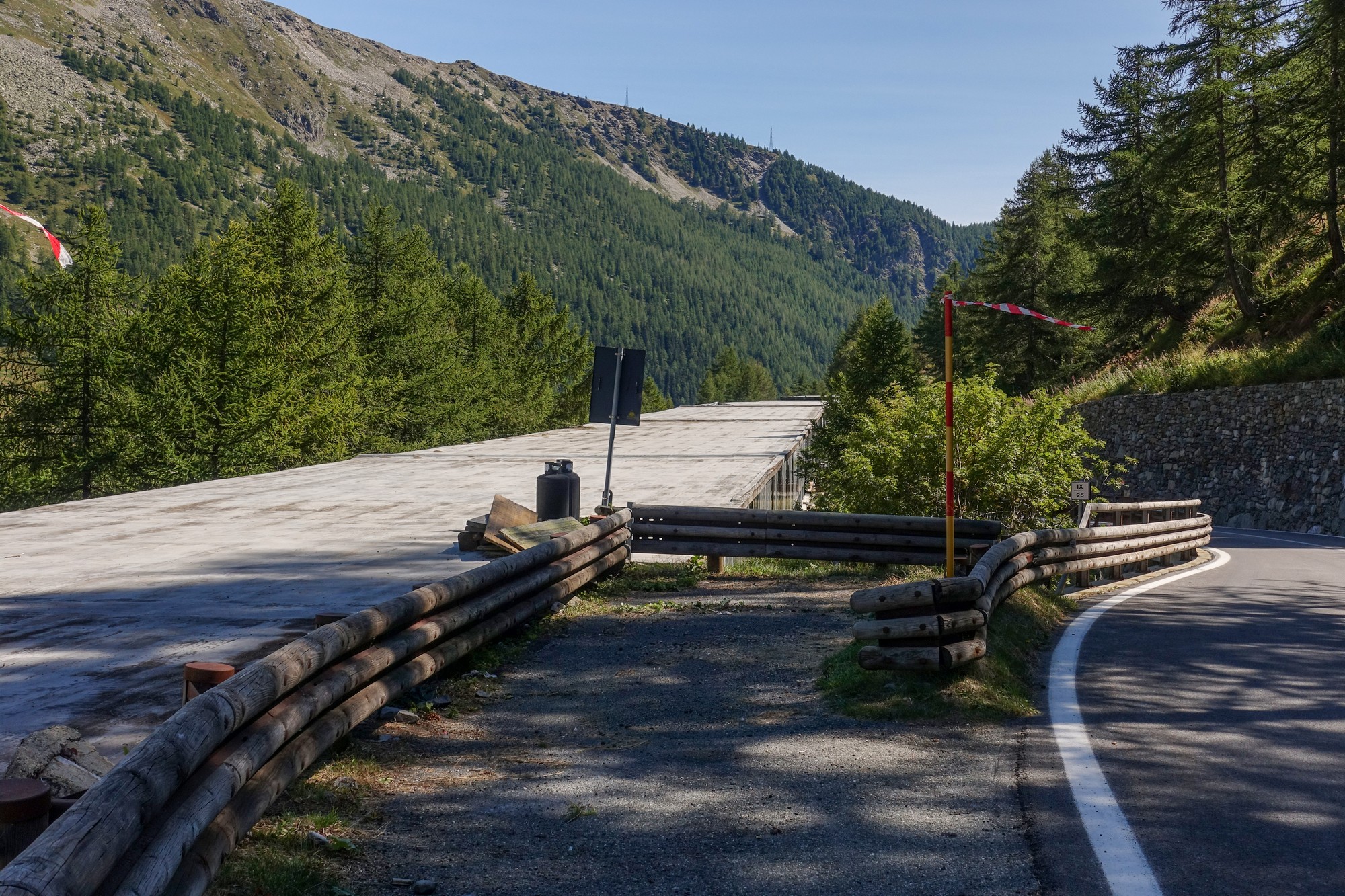
In the forest section I could hear traffic on the enclosed autostrada which was just up to the left of me at first, but then I crossed under it. Possibly the ugliest piece of motorway engineering I’ve seen, completely out of keeping with the beautiful mountain scenery. The road is covered by an avalanche gallery to allow the tunnel to stay open all year.
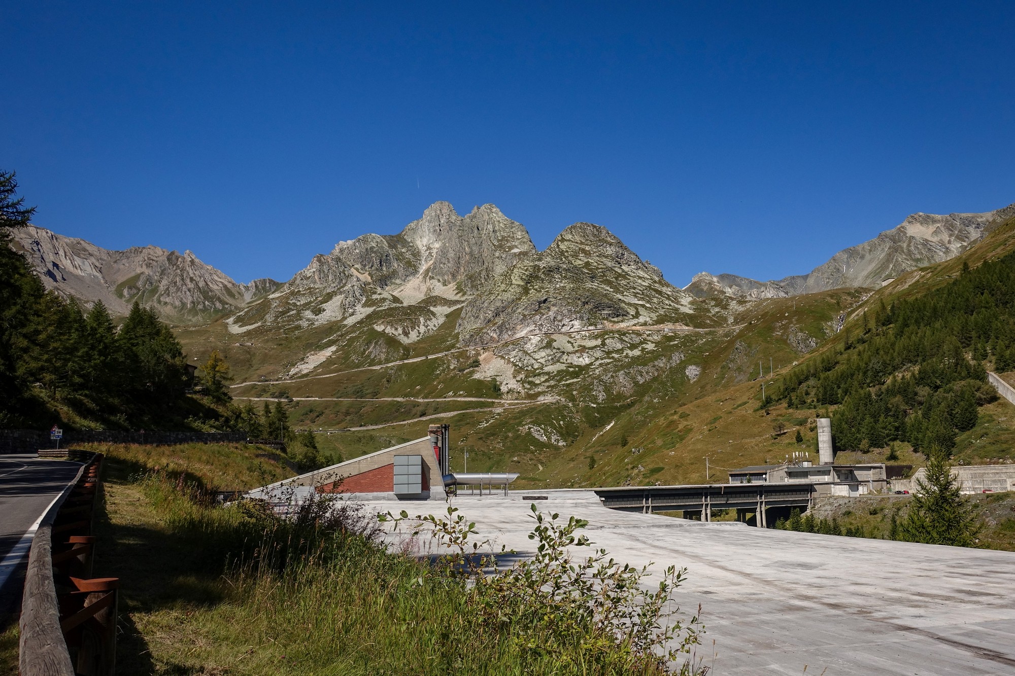
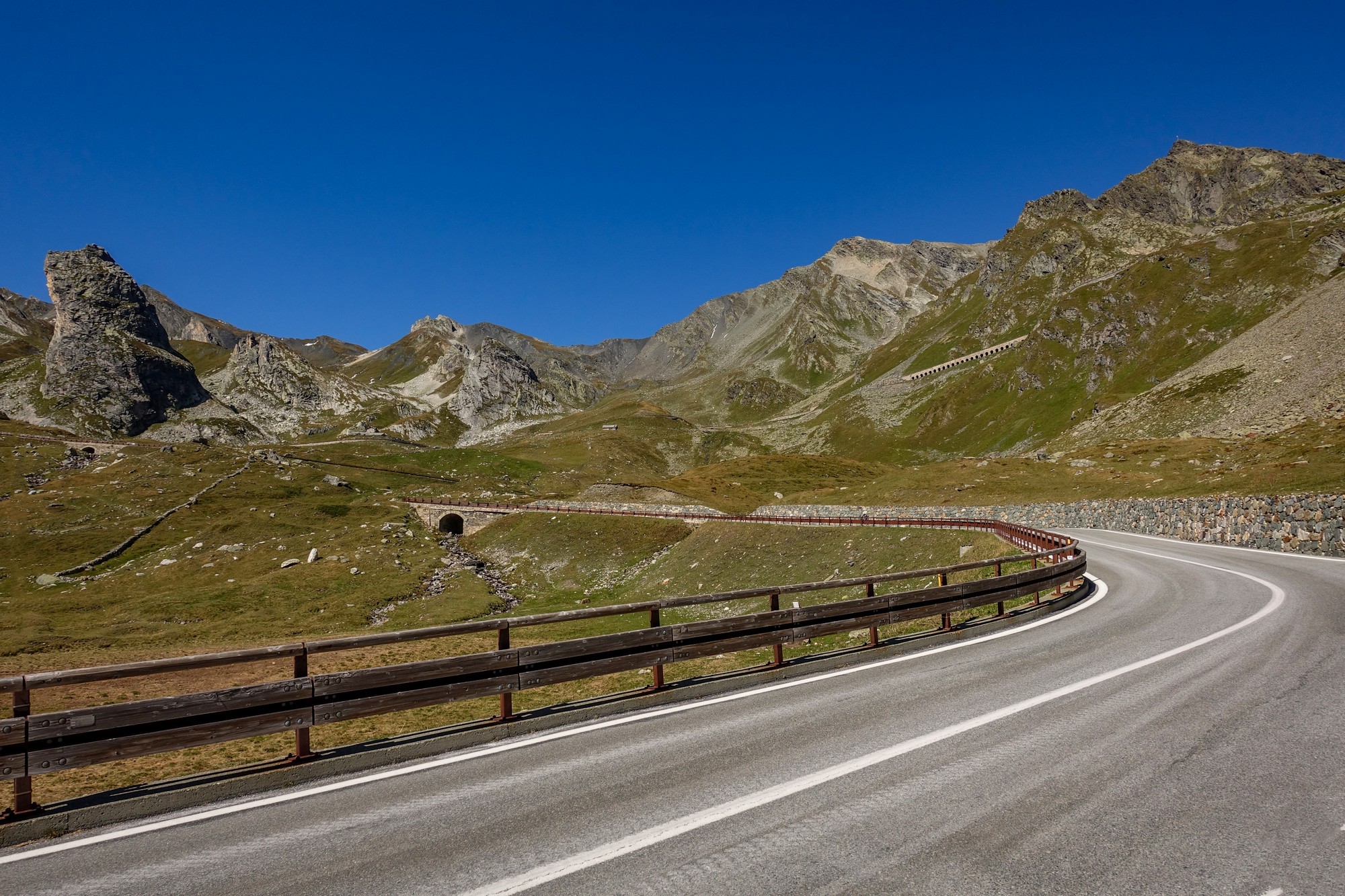
At that point I stopped to put my arm warmers on and had another ¼ of my sandwich. Also I took a couple of pain killers because I felt I was getting an altitude headache, there at 1,990 metres. I could see the road climbing the mountain ahead in three long switchbacks. I wondered if the col was just at the top of those (answer: no, it wasn’t).
The gradient was really manageable but that strong northerly headwind coming down from the col really added quite a bit to the challenge, except on those switchbacks facing south, when I was able to change to a higher gear by about two or three sprockets, which gives a good indication of how strong the wind was as it helped me up those bits.

Once past the ugly concrete autostrada and now above the treeline, it is a beautiful road that winds its way up to the col, and it looked glorious in today’s sunshine. Shame about the wind. I slogged my way up there, seeing the road I’d climbed falling away behind me.
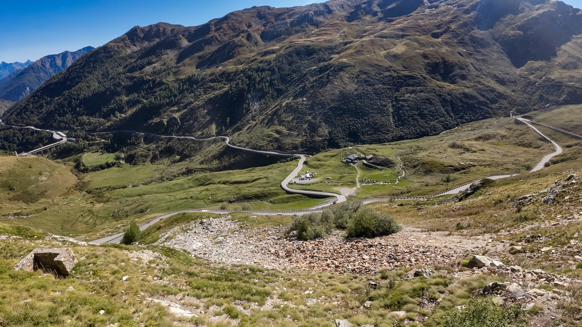

Just past the end of those three long switchbacks, about 40 minutes later, I saw a motorhome with British plates parked up and a guy standing taking photos. So I stopped for a chat. Subjects discussed included motorhome brakes, places visited, and the weather. They were on their way back to the UK. It gave me a welcome break from the climb. He said “you’re nearly there now” and pointed up the mountain “just up there”.
He wasn’t too far off the mark – 24 minutes later I had battled up those increasingly windy slopes to reach the lake.

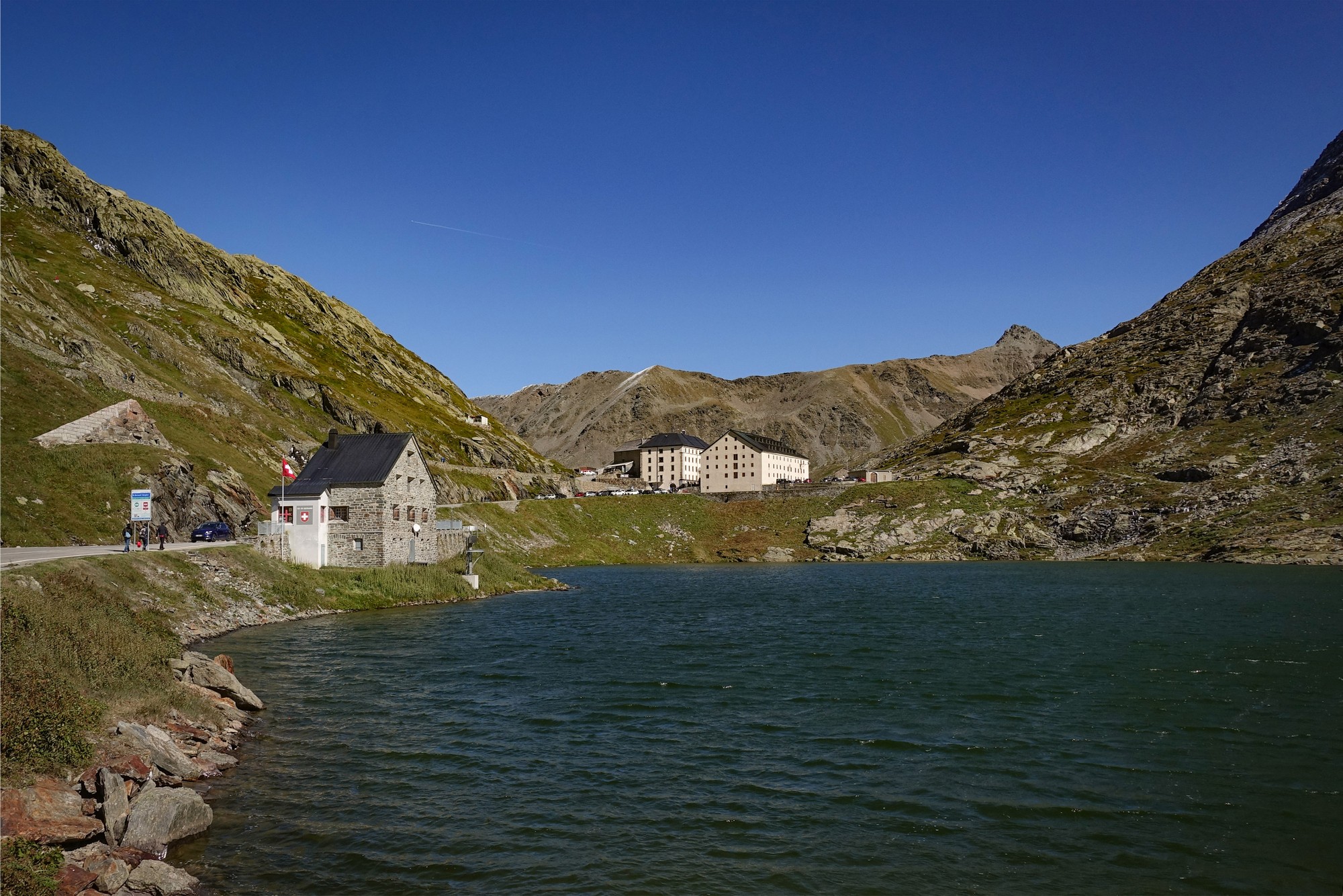
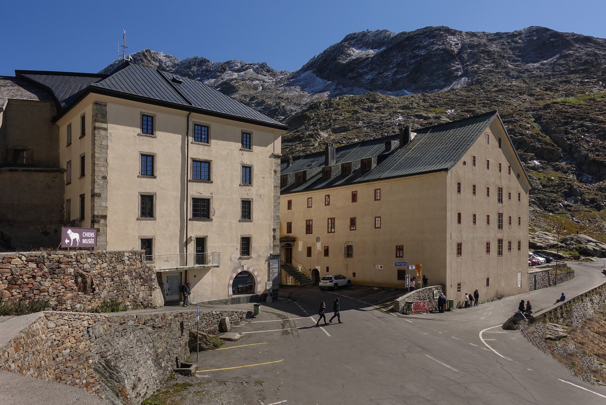
I carried on riding past the lake to the highest point, at the hospice, and then went beyond to look at the view over the Swiss side.
As I stood there, taking in the view, a touring cyclist (visible in the photo above) arrived from the Swiss side and shouted ‘woo-hoo’ or something, in celebration of his achievement. We started chatting. He was German. I wondered if he’d had a tailwind on that side of the col but he said he hadn’t noticed one; he pointed to his heavily loaded bike and said it wouldn’t help that much anyway. He was heading south down through Italy. Back up at the lake I noticed him standing next to the col sign chatting to another touring cyclist. Later, I spoke with the second guy – he was on his way to Corsica via Genoa. I mentioned Club de Cent Cols to him – he’d never heard of it but he sounded interested because he asked me to repeat the name towards the end of our conversation. He mentioned there’d been a weather warning for strong winds. I said he should be careful on the descent because it might switch from a tailwind to a headwind as soon as you go round a switchback.

I parked my bike overlooking the lake while I put my rain jacket and snood back on and ate the remainder of my cheese sarnie.

I took a few more photos before starting the descent The advice I’d given that tourer soon proved right. The wind on the top section of the descent really ruined it. That would be a totally amazing downhill in calmer weather. I video’d most of it (see below) and stopped for a couple of photos near the top.

I took it easy on the windy bits. It wouldn’t have been so bad if it were a completely empty road but the traffic (esp from behind) made it risky in case I got blown into the road or the edge. To give an idea how much the wind affected my descent, my average speed over the first five miles down to the tunnel was just 18.6 mph, with the first mile nearer to 14. For the following, less steep, six miles from the tunnel down to Étroubles my average was 27mph, the wind being less of an issue further down. Quite a difference.
I was freezing cold at the start of the descent (although not the worst I’ve been). Further down it warmed up and the wind was less severe. On the last section down to Gignod I was going at the same speed as the traffic (I glanced and saw 35mph). I got back feeling elated, as is normal after a major achievement and a long descent.
Generally I prefer wild mountain passes with no buildings, no armco, no ski paraphernalia, no traffic, etc; passes like Col de la Bonette, Col de la Cayolle, etc. Col du Grand Saint-Bernard is not one of those, and I had been warned about lots of traffic, so it wasn’t high up on my list to do. Despite that, I really enjoyed today’s ride. Being an out-of-season Sunday there wasn’t much traffic at all. The first 13-mile alternative route from Aosta was very quiet. There was just 2 miles of busy road between Étroubles and the E27 turn-off for the tunnel. Then the nine-mile climb to the col was fairly quiet traffic-wise, as can be seen in the videos. Acknowledging that this is an important main crossing between Italy and Switzerland, I can forgive it its wide roads, armco and buildings, car parks, etc at the top. In fact I found the lake and the surrounding buildings very attractive. And the road surface was perfect throughout. Today’s climb was not quite as long as Col de l’Iseran from Bourg-Saint-Maurice, which is almost 30 miles, but in many respects they’re quite similar.
So this ride was more enjoyable than I had expected. The only fly in the ointment was that strong gusty wind near the top. Everything else was ideal. I’m really happy to have ticked this big climb off my list.
Further reading
- Great St Bernard Pass – Excellent article with loads of history, etc (Wiki, Eng.)
- Great St Bernard Tunnel – Official site for the tunnel with history (Eng.)
- Great St Bernard Tunnel – Wikipedia (Eng.)
Fuel
Gallery
Click to enlarge / see slideshow